




Somewhere on the slopes of a 10,000-foot mountain south of Kohima grows a tree that made it into the Guinness Book of World Records — not for a fruit or a flower, but simply for being enormous. Japfü Peak, Nagaland’s second-highest summit after Mount Saramati, holds that record: the world’s tallest rhododendron tree, discovered in 1993. But the tree is really just the opening act. Japfü Peak itself is one of Northeast India‘s most rewarding single-day treks, a climb that takes you from cultivated farmland through dense montane forest, into a genuinely disorienting bamboo maze, and up a thrilling final rock scramble to twin summits with views stretching toward Myanmar.
If you’ve been exploring our Nagaland travel coverage and want a trek that delivers real drama without demanding a multi-day expedition, this is it.
Quick Facts About Japfü Peak
| Location | Kohima district, Nagaland, ~15 km south of Kohima |
|---|---|
| Elevation | 3,048 m (10,000 ft) |
| Rank | Nagaland’s 2nd highest peak, after Mount Saramati (3,826 m) |
| Parent Range | Barail Range |
| Trailhead Village | Kigwema (also accessible via Phesama, Viswema, Zakhama) |
| Trek Distance | Approximately 8-9 km round trip |
| Vertical Gain | Approximately 1,250 m from trailhead to summit |
| Time Required | 5-8 hours round trip (single day, no overnight needed) |
| World Record | Tallest rhododendron tree on Earth (20 m / 65 ft, GWR-verified) |
| Best Time to Visit | October-February (winter) or March-April (pre-monsoon) |
| Entry Fee | Approx. ₹20-50 (Indians), ₹100-150 (foreign nationals) |
Where Is Japfü Peak?
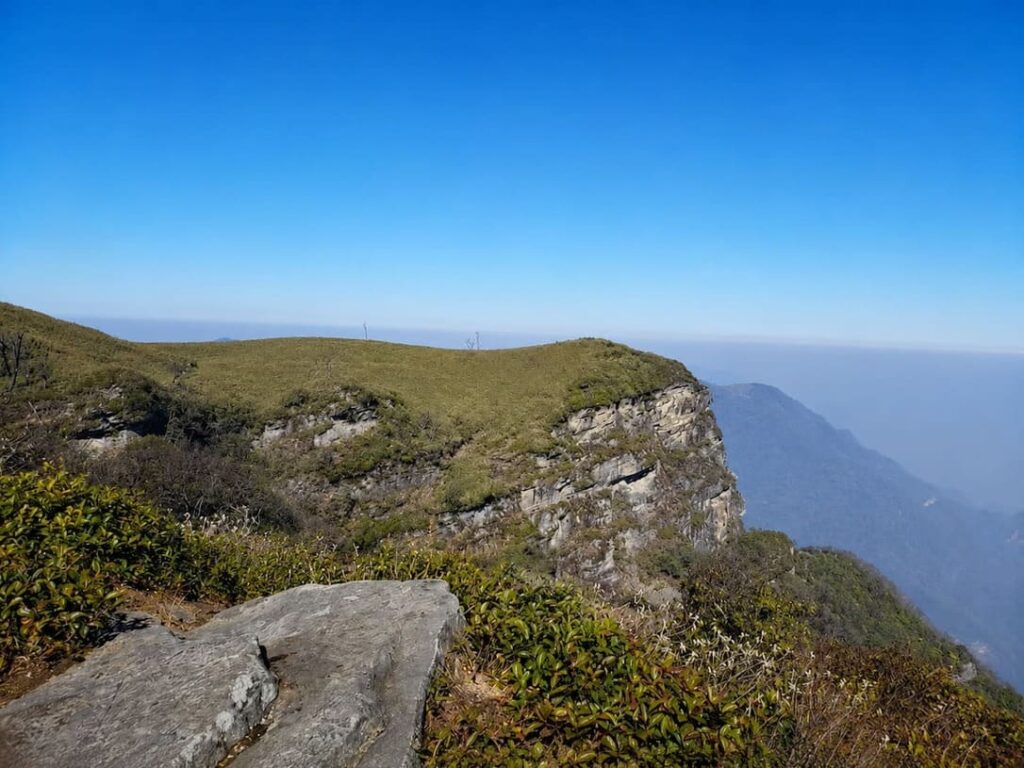
Japfü Peak sits in the Barail Range in Kohima district, roughly 15 km south of Nagaland’s capital, in the heartland of the Angami Naga community. It stands as the highest point in the Barail Range and receives snowfall between December and February — a genuine rarity this far into Northeast India’s subtropical hill country.
The peak holds deep spiritual significance for the Angami tribe, woven into their oral traditions, and its oak and rhododendron forests shelter the rare Blyth’s Tragopan, Nagaland’s state bird, alongside serow, barking deer, and the occasional Asiatic black bear.
The World’s Tallest Rhododendron Tree
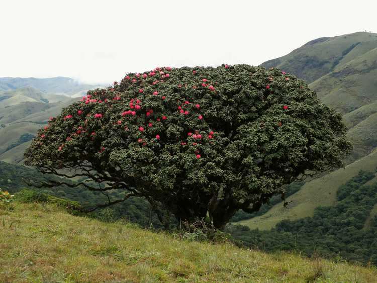
Japfü’s headline claim to fame is a single tree, discovered in 1993 and entered into the Guinness World Records for the “Largest Rhododendron.” According to Guinness World Records’ own listing, the tree is a scarlet Rhododendron arboreum reaching a verified height of 20 metres (65 feet). You’ll see higher figures — 108 or 109 feet — repeated across several Nagaland tourism and news sources, but that specific number doesn’t appear on GWR’s official record page, so the 20 m / 65 ft figure is the one to trust as the confirmed record.
The tree blooms in vivid red flowers each spring and stands near the base of Japfü rather than directly on the standard Kigwema summit trail. Most day-trekkers never actually see it — reaching the tree typically requires a separate detour with a local Angami guide who knows the route, since there are no trail markers pointing to it from the main path.
Do You Actually Need a Guide?
This is one of the more genuinely debated questions among Japfü trekkers. Several tour operators insist the climb requires two full days with a mandatory overnight base camp, but experienced independent trekkers who’ve documented the route firsthand describe it as a comfortable single-day round trip, taking 5 to 8 hours depending on fitness, pace, and whether you start before dawn for sunrise views.
The trail is intuitive enough that route-finding isn’t a major concern for most of the climb — right up until the bamboo maze near the summit, covered below, where a guide’s local knowledge genuinely earns its keep. Guides are available in Kigwema, Phesama, or Viswema for a modest daily rate, and beyond navigation, they can identify flora and fauna, share Angami folklore, and point you toward the record rhododendron tree if you want to see it. If you’re inexperienced with mountain hiking, a guide is the sensible call; confident, fit hikers comfortable on an unmarked but well-trodden trail can genuinely do this independently.
The Route: A Stage-by-Stage Breakdown
The most commonly used route begins at the outskirts of Kigwema village, about 15 km south of Kohima. From there, a turn-off leads onto a dirt road toward Japfu Christian College; the trailhead itself starts just beyond a hairpin bend near a horse stable locally called the Pony Farm, where a wooden stile marks the point vehicles can no longer follow.
| Trail Stage | Terrain & Key Markers | Difficulty |
|---|---|---|
| Farmland | Potato patches, jhum-cultivated fields, stone rest huts | Easy, gradual |
| Old-growth forest | Moss-covered roots, a dilapidated wooden midpoint rest house | Moderate, steep |
| The bamboo maze | Dense dwarf bamboo, 8-10 ft tall, blocking the horizon | Disorienting |
| Summit scramble | Exposed rock face, hand-cut footholds, fixed steel cable | Challenging |
The cultivated valley: The trail climbs gently through farmland where locals grow potatoes, cabbage, and maize under traditional jhum cultivation, with stone-walled rest huts dotting the fields.
Dense montane forest: Beyond the fields, the trail enters steep, heavily shaded old-growth forest, passing a dilapidated wooden rest house near the midpoint before opening onto a ridge.
The bamboo maze: This is the section most trek write-ups skip past, and it deserves more attention. Near the saddle between Japfü’s twin peaks, the terrain flattens into what looks, from a distance, like a neatly mowed lawn. It isn’t — that “lawn” is dense dwarf bamboo standing 8 to 10 feet tall, thick enough to swallow the horizon completely. Trekkers describe losing all sense of direction here, with every turn looking identical to the last; the only way through is to strictly follow the faint path trodden by previous hikers, since wandering off it means circling the same bamboo blindly.
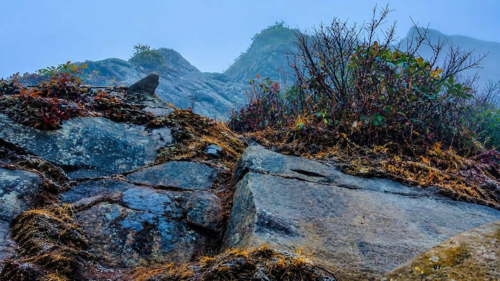
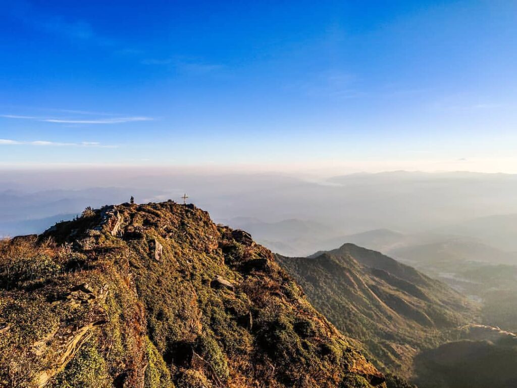
The summit scramble: Beyond the bamboo, the trail reaches the first of Japfü’s twin peaks, then continues through a second bamboo stretch toward the higher second summit. The final approach is a near-vertical rock face fitted with hand-cut footholds and, on the steepest section, a fixed rope or steel cable. A small cross marks the true summit.
From the top, on a clear day, you can see Kohima, the villages of Kigwema, Mema, Pfutsero, and Viswema, and the folds of Dzükou Valley below to the west.
⚠️ The No-Water Rule on Japfü: Once you clear the lower farmland, there are no streams, springs, or water points anywhere along the forest trail, the bamboo maze, or the summit ridge. Multiple documented treks confirm this explicitly — pack a minimum of 2-3 litres of water per person before you leave the valley floor, and don’t count on finding any natural water source on the mountain itself.
Japfü Peak vs Dzükou Valley: How Do They Compare?
These two destinations sit almost next to each other and are frequently combined into a single trip, but they offer very different experiences.
| Feature | Japfü Peak | Dzükou Valley |
|---|---|---|
| Elevation | 3,048 m | ~2,438 m |
| Experience | Steep single-day summit climb, bamboo maze, rock scramble | Multi-day valley trek, rolling meadows |
| Highlight | World’s tallest rhododendron, twin-peak summit views | Seasonal lilies, rhododendron blooms, camping |
| Difficulty | Moderate-to-challenging, exposed final section | Moderate, more sustained walking |
| Time Needed | 5-8 hours round trip | 1-3 days depending on itinerary |
If Dzükou is about immersing yourself in a valley, Japfü is about earning a summit. Trekkers based in Kohima frequently do both across a single trip — our Dzükou Valley trekking guide covers that route in full detail.
Best Time to Climb Japfü Peak
Winter, from October to February, offers the driest trails and clearest visibility, though the summit can drop below freezing and even see snowfall from mid-December onward. The pre-monsoon window, March to April, is another solid option, typically warmer and still reasonably dry, and coincides with the rhododendron bloom.
Avoid the monsoon months from May to September if possible. Rain makes the rocky final ascent considerably more treacherous, and leeches become a genuine nuisance in the forested sections. Winter days are also short, with sunset around 4:30 pm in December, so starting early is essential to avoid descending the exposed rock sections in fading light.
Permits: What Non-Residents Need in 2026
Nagaland requires an Inner Line Permit (ILP) for every non-resident Indian citizen. As of 2026, apply online through Nagaland’s official ILP portal, or in person at physical counters in Dimapur or Kohima. Costs remain modest — around ₹50 for 15 days, ₹100 for 30 days.
Foreign nationals face a lighter framework than several neighbouring states, since Nagaland’s Protected Area Permit rules have been significantly relaxed. Foreign travellers staying longer are still expected to register with the local Foreigners Registration Officer (FRO) or nearest police station within 24 hours of arrival — worth confirming with your hotel or guide, since procedure can vary slightly by district.
Alco Check Out Our NE Travel Permit Assistant
How to Reach Japfü Peak
- Fly or take the train into Dimapur, roughly 70-74 km from Kohima.
- Continue by road to Kohima, via shared taxis, cabs, or buses from Dimapur.
- Drive approximately 15 km south of Kohima toward Kigwema village, branching onto the dirt track to Japfu Christian College.
- Park at the trailhead near the Pony Farm hairpin bend, where the walking trail begins.
Taxis and shared jeeps from Kohima to Kigwema, Phesama, or Viswema are the standard way to reach the base — there’s no direct public transport to the trailhead.
What to Pack for the Climb
- Sturdy hiking shoes with good grip, essential for the exposed rock sections, which get considerably more treacherous when wet.
- A minimum of 2-3 litres of water per person — there is no water source anywhere past the farmland.
- Energy-dense snacks for the 3-5 hour ascent.
- A warm layer or two; the bamboo maze and summit ridge are noticeably colder and windier than the trailhead.
- A headlamp, particularly if you’re starting before dawn for sunrise views or if your descent runs later than planned.
- Salt or anti-leech socks if trekking during the monsoon months.
Final Thoughts
Japfü Peak rewards exactly the kind of traveller who wants a genuine physical challenge without committing days to it — farmland, forest, a disorienting bamboo maze, and a proper rock scramble, all compressed into a single unforgettable day, with a world-record tree and panoramic Naga Hills views as the payoff. Pair it with a Dzükou Valley trek if you have the time, and you’ll have covered two of Nagaland’s finest natural experiences in one trip.
For more from this part of Nagaland, browse our Nagaland travel coverage or check our Northeast India tourism guide for help planning a longer regional itinerary.
