




There is a moment, standing at the viewpoint above Nohkalikai Falls, when the waterfall does something unexpected. It disappears. The mist that rises from the plunge pool below meets the clouds that press in from the Khasi Hills above, and for a few seconds the entire 340-metre drop is swallowed in white. Then the wind shifts, the curtain opens, and the falls appear again — a single silver ribbon falling from the plateau edge into a pool of extraordinary emerald green so far below that the roar of the impact reaches you a full second after you see it. It is one of the most theatrical landscapes in India.
Nohkalikai Falls, located near Sohra (Cherrapunji) in the East Khasi Hills district of Meghalaya, is India’s tallest plunge waterfall. At 340 metres (1,115 feet), the water drops freely from the edge of the Cherrapunji plateau in a single unbroken fall — a horsetail of water that does not touch the cliff face until it explodes into the pool below. But the falls are more than a geological superlative. They carry a name that tells one of the most haunting stories in Khasi oral tradition, and standing here with that story in mind gives the landscape a weight that pure scenery cannot.
Quick Facts About Nohkalikai Falls
| State | Meghalaya |
| District | East Khasi Hills |
| Height | 340 metres (1,115 feet) — India’s tallest plunge waterfall |
| Type | Plunge waterfall — single unbroken drop, no contact with the cliff face |
| Location | Approximately 7.5 km from Sohra (Cherrapunji) town |
| Distance from Shillong | Approximately 55 km; 1.5–2 hours by road |
| Plunge Pool | Turquoise-to-emerald green; colour shifts with season and light |
| No ILP Required | Meghalaya is open to all Indian and foreign nationals — no Inner Line Permit |
| Entry Fee | Approximately ₹20–₹30 per person |
| Best Time | October–November (peak flow + clearer skies); July–September (maximum volume) |
The Legend of Ka Likai — Why the Nohkalikai Falls Have This Name
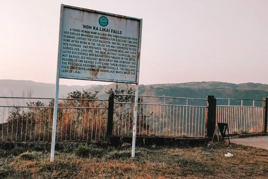
‘Nohkalikai’ is a Khasi compound: Noh means jump, Ka is the female prefix in the Khasi language, and Likai is the woman’s name. The name translates as the leap of Ka Likai, and the story it memorialises is one of the most devastating in the Northeast’s oral tradition.
Ka Likai was a young mother in the village of Rangjyrteh, approximately three kilometres from the falls. Her first husband died young, leaving her with an infant daughter and no income. To feed her child, she took on heavy labour as a porter — carrying loads of iron ore between villages. The work was exhausting and kept her away from home for long hours. Under pressure from friends concerned about her daughter’s welfare, she eventually remarried.
Her second husband, however, resented the infant girl. He believed that Ka Likai’s love for her daughter consumed all the attention that should have been his. One afternoon, while Ka Likai was away working, he murdered the child, cooking the flesh and discarding the bones and severed head to conceal what he had done.
Ka Likai returned home exhausted and hungry. Her husband had prepared a meal. She ate. Afterwards, she reached for her customary betel quid — and found something in the basket among the betel nuts. A severed finger. Her daughter’s finger.
What happened next is not described slowly in the Khasi telling. Ka Likai understood immediately. She began to run — through the village, across the plateau, hatchet in hand, until she reached the edge of the cliff. And she jumped.
The waterfall was named in her memory. It is not a monument to a suicide so much as a record of a grief so complete that the earth itself was marked by it. Local people treat the name with the seriousness it deserves. Visitors who learn the story before arriving find that they stand at the viewpoint differently.
| Traveller’s note: The legend of Nohkalikai is shared by local guides because it is central to the waterfall’s identity — not because it is entertainment. Approach it as you would any story of real human suffering: with quiet respect rather than dramatic enthusiasm. Night camping near the falls is traditionally discouraged; local belief holds that Ka Likai’s grief can still be heard in the sound of the water after dark. |
Nohkalikai Falls — What You Actually See
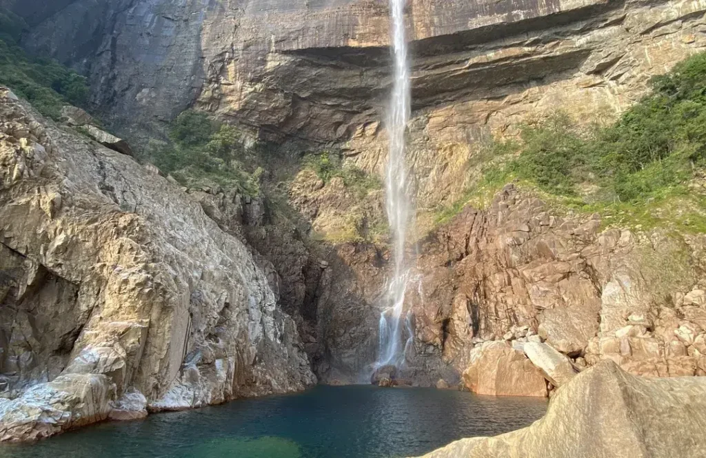
The Drop & the Plunge Pool
The 340-metre drop at Nohkalikai Falls is classified as a plunge waterfall — meaning the water leaves the cliff edge in free fall, maintaining contact with nothing until it hits the pool below. At peak monsoon flow (July–August), the full width of the falls spans approximately 23 metres; by February, the dry season narrows it to a fraction of that. The plunge pool below changes colour through the year: deep turquoise in the dry winter months when the water runs clear over limestone, shifting to a milky green-grey during monsoon when the volume is at its most violent.
The Viewpoint
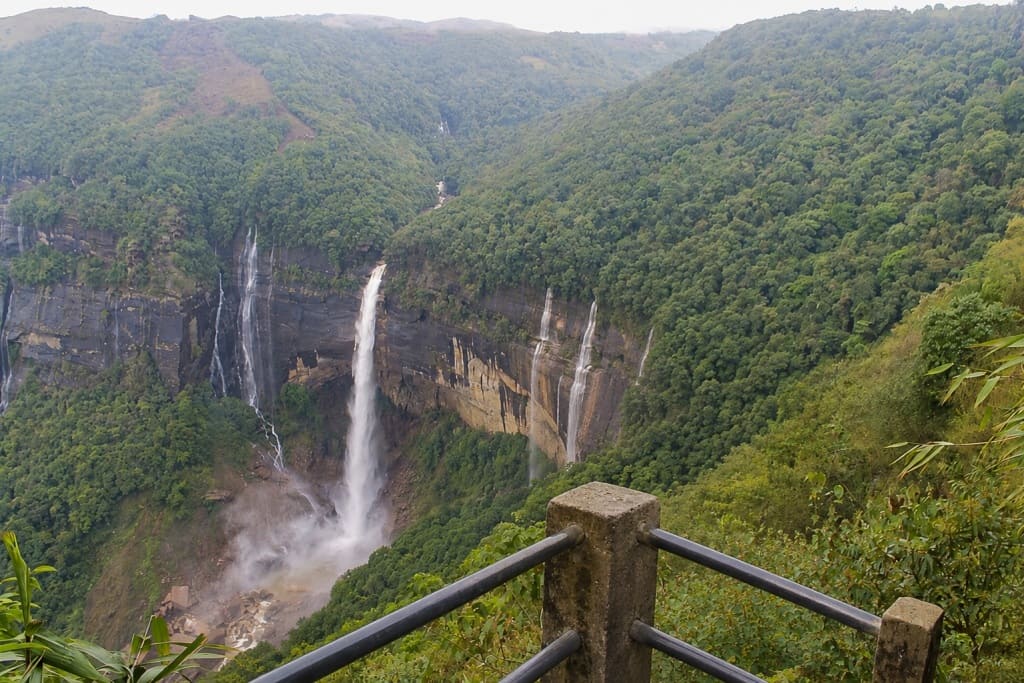
The main viewpoint is a short walk from the parking area — a paved path to a fenced observation deck above the plateau edge. The falls descend below and to the front of the viewpoint rather than facing it directly, which means you are looking across and slightly down into the drop rather than at it head-on. The surrounding cliffs, covered in subtropical forest and frequently threaded with lesser waterfalls, frame the main drop.
- Small shelters and benches at the viewpoint — useful for waiting out the frequent mist windows
- Rainbows form regularly in the spray when morning sun hits the mist above the pool
- The roar of the water is audible from 500 metres before the viewpoint on a high-flow day
- Small vendors near the entrance sell tea, local snacks, and basic waterproof ponchos
| Photography tip: Visit between 10 AM and 1 PM on clear days for the best chance of a rainbow in the spray and direct sunlight on the falls face. Early morning is frequently misted over and the falls may be invisible. Afternoon visits in October–November offer the golden light combination that most Nohkalikai photographs use. |
The Geology
The falls are fed entirely by rainwater collected on the small plateau above — no major river feeds Nohkalikai. The plateau sits on Cretaceous-Paleogene sandstones and limestones, and the water table rises so rapidly during the monsoon that the falls go from a moderate flow in May to an overwhelming torrent by July. The falls cascade over the same sandstone cliff formation that characterises the southern escarpment of the Meghalaya plateau — the geological structure responsible for both the waterfall and the region’s extraordinary rainfall totals.
Seasonal Guide — When to Visit
- October to November — The recommended window. Monsoon has ended; the falls are still at high volume from the season’s rainfall; skies are intermittently clear enough to see the full drop. The plunge pool is at its most vivid green. This is the sweet spot between maximum flow and actual visibility.
- July to September (Monsoon) — Maximum volume and drama. The falls are thunderous, the surrounding cliffs are waterfalling from every crack, and the landscape is intensely, almost painfully green. However, the viewpoint is frequently obscured by mist for hours at a time. Road conditions to Cherrapunji can be wet and slow. For travelers specifically visiting for the falls, this period demands patience and flexibility.
- December to February — The dry season progressively reduces the flow; by January the falls are narrow and the plunge pool loses its depth of colour. The viewpoint is usually clear and the drive from Shillong is fast and comfortable. Better for the overall Cherrapunji circuit; not ideal for the waterfall itself.
- March to May — Pre-monsoon warming. Water levels are moderate and rising. The surrounding forest is in new leaf. A reasonable time to visit if Nohkalikai is one of several Meghalaya stops rather than the primary purpose.
Combining Nohkalikai with the Cherrapunji Circuit
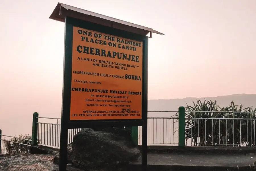
Nohkalikai Falls is 7.5 km from Sohra (Cherrapunji) town and is best visited as part of a full Cherrapunji day from Shillong. The standard circuit from Shillong covers:
- Seven Sisters Falls viewpoint (on the descent from Shillong toward Cherrapunji) — Bangladesh plains visible in clear conditions
- Nohsngithiang Falls (Seven Sisters) — multiple parallel strands across a wide cliff face
- Mawsmai Cave — the most accessible limestone cave in Meghalaya; 150 metres of illuminated passage
- Nohkalikai Falls viewpoint — 45 minutes to 1.5 hours depending on weather and photography
- Eco Park Cherrapunji — another viewpoint over the Bangladesh plains; the garden setting is pleasant
| Planning note: The Shillong–Cherrapunji–Nohkalikai circuit is 110–120 km return and takes a full day. Depart Shillong no later than 8 AM to give yourself time at each stop. The road is good but winding. Most tourists move through Nohkalikai quickly (30–45 minutes) — if you have read the legend beforehand, you may find you want to stay longer. |
How to Reach Nohkalikai Falls
- From Shillong: 55 km on NH6 toward Cherrapunji (Sohra); approximately 1.5–2 hours by road. Take the turn toward Sohra town and continue 7.5 km to the falls viewpoint.
- By private taxi from Shillong: ₹1,800–₹2,500 for a full-day Cherrapunji circuit including Nohkalikai; the most practical option for groups of 3–4.
- By bus: Shared buses from Shillong’s Police Bazar to Cherrapunji operate throughout the morning; journey 1.5–2 hours; from Sohra town, take a local taxi (₹100–₹150) the 7.5 km to the falls.
- From Guwahati: Approximately 165 km; 4–4.5 hours. Most travelers stay overnight in Shillong and do Cherrapunji as a day trip.
Travel Essentials
- No ILP or permit required — Meghalaya is open to all travelers
- Waterproof jacket or poncho: mandatory at any season; the falls generate their own localised mist that will soak you in minutes at the viewpoint
- Footwear: the viewpoint path is paved but can be slippery from mist; avoid sandals
- ATMs: available in Cherrapunji town; no ATMs at the falls viewpoint; carry cash for entry, snacks, and taxi
- Entry fee: approximately ₹20–₹30 per person; no camera fee for standard cameras
