




Somewhere in the far eastern corner of Arunachal Pradesh, where India, China, and Myanmar nearly touch each other, nine Meyor tribal families live in a village called Dong. Every single morning, before the rest of the country has stirred, the first rays of the sun hit the ridgelines above Dong Valley. Trekkers set off from the village at two in the morning — in complete darkness, with headlamps and warm layers — to climb a steep pine-clad ridge in time to watch that moment happen.
Dong is one of the most unusual travel experiences in all of Northeast India, and almost nobody outside the region has heard of it. If you have been exploring our Arunachal Pradesh coverage and wondering what lies at the very edge of the country, this is the guide that answers that question.
Quick Facts About Dong Valley
| Location | Anjaw district, Arunachal Pradesh, near the India-China-Myanmar trijunction |
|---|---|
| Village | Dong, on the eastern bank of the Lohit River |
| Tribe | Meyor (Mishmi tribes in the wider district) |
| Elevation | 1,240 metres (4,070 ft) |
| Population | 9 families (~50 residents, up from 15 at the 2011 census) |
| Distance from Walong | 7 km via suspension bridge (~30-min walk) |
| Distance from Dibrugarh | ~400 km, two full driving days |
| Best Time to Visit | March to May; October to December |
| Permits | ILP + PAP both required for Indian nationals; foreigners barred from border zone |
| Trek Guide Fee | ₹500 per person; treks start at 2 am, viewpoint reached by 4.30 am |
| Last ATM | Hayuliang |
| Last Fuel Station | Khupa (~4 km before Hayuliang) |
On-the-Trail Tactical Matrix
| Trail Stage | Terrain | Effort | Critical Gear |
|---|---|---|---|
| Stage 1: Lohit Crossing to Plateau | Suspension bridge; switchbacks through bamboo | Moderate (~30 min) | Trekking boots; headlamp |
| Stage 2: Pine Forest Ascent | Steep zigzag through dense pine, big vertical gain | High (90–120 min) | Trekking poles; windcheater |
| Stage 3: Ridge Viewpoint | Exposed alpine ridgeline; stationary wait | Light/Waiting | Thermal beanie; hot flask |
Why Dong Gets India’s First Sunrise
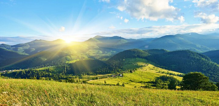
The claim isn’t marketing — it’s geography. Dong’s position at 1,240 metres on India’s extreme eastern longitude means its ridgelines catch sunlight before any other inhabited point in the country, a fact formally verified in 1999. On New Year’s Day 2000, the village hosted a millennium sunrise celebration that put it on the national map.
In practice, that means being ready by midnight, starting the trek at 2 am, and watching the sun “bloom like a ball of fire” from the ridgeline by around 4.30 am, according to local guide Yonten Meyor. The nine Meyor families rotate guiding duties through the season, charging ₹500 per person with discounts for groups.
The Meyor Tribe: Language, Homes, and the Darcho
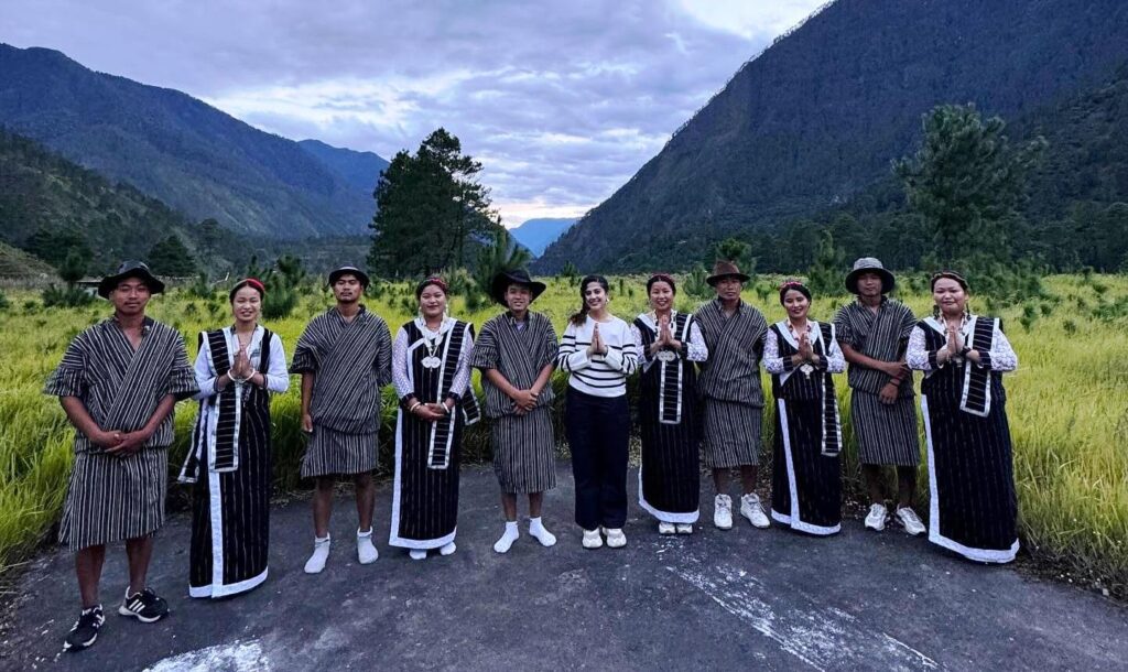
The Meyor are a small Tibeto-Burman community concentrated in the Kibithoo and Walong circles of Anjaw district. Unlike the largely animist Mishmi tribes of the same district, the Meyors blend animism with Mahayana Buddhism — the region’s earliest Gonpa was built in 1960 at nearby Kaho village.
Their agro-pastoral lifestyle combines terraced rice and maize farming with limited yak herding on the higher pastures, and their homes are traditionally raised on wooden stilts to withstand the monsoon and cold. Look for Darcho — tall poles strung with Buddhist prayer flags — at trail junctions and around the village; for the Meyors, these carry prayers into the wind and guard the settlement from malevolent spirits. Their most prominent festival is Losar, the Tibetan-influenced lunar New Year.
Walking the 1962 Battlefield at Walong
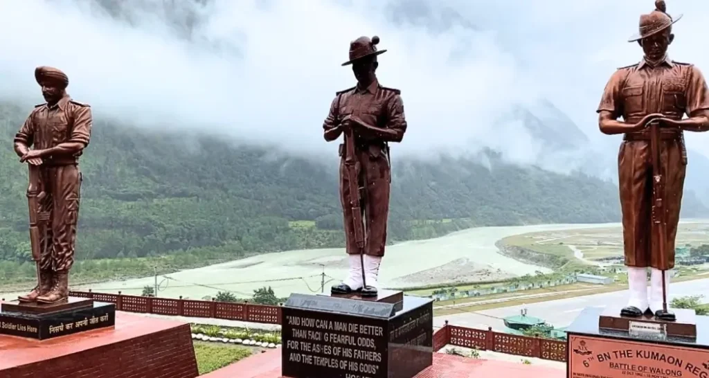
No trip to Dong Valley is complete without a stop at Walong’s war memorials. In October 1962, the Indian Army’s 11th Infantry Brigade — 6 Kumaon, 4 Sikh, 3/3 Gorkha Rifles, and 4 Dogra — held the Walong sector against a far better-supplied Chinese force in what became the only Indian counterattack of the entire 1962 war.
At Namti Nullah, nicknamed Tiger’s Mouth, Lt. Bikram Singh of 6 Kumaon famously weakened a hanging bridge’s planks and ambushed Chinese troops crossing it before dawn. By 16 November, low on ammunition and rations, Indian troops withdrew south to Hayuliang; combined casualties numbered 642 Indians and 752 Chinese — one of the most evenly fought engagements of the war.
The main Walong War Memorial, built in 1965 near the airstrip, carries the epitaph: “The sentinel hills that round us stand bear witness that we loved our land… we fought and died on Namti Plain.” It was newly renovated and reopened in November 2024 for the battle’s 62nd anniversary. Nearby, the Helmet Top Memorial marks the cliff where soldiers’ gear was recovered decades later, and the Kibithu Hut of Remembrance honours Vir Chakra awardee Bahadur Singh.
The Driving Route: Dibrugarh to Dong Valley
This is a two-day drive from Dibrugarh with a mandatory overnight in Anjaw district. Plan every fuel stop in advance — there are no alternatives once you pass Tezu.
| Stage | Route | Distance | Drive Time |
|---|---|---|---|
| 1 | Dibrugarh → Tinsukia → Namsai | ~130 km | 2.5–3 hrs |
| 2 | Namsai → Tezu | ~75 km | 1.5–2 hrs |
| 3 | Tezu → Hayuliang/Khupa | ~100 km | 4–5 hrs |
| 4 | Hayuliang → Hawai | ~58 km | 2–3 hrs |
| 5 | Hawai → Walong | ~90 km | 3–4 hrs |
| 6 | Walong → Dong (on foot) | 7 km | ~30 min |
Dibrugarh to Tezu: The route enters Arunachal at Dirak Gate, where your ILP is checked, then runs through tea-garden flatlands to Tezu — the last genuinely well-serviced town on this road. Fill your tank completely here, get any vehicle issues addressed, and stock up; Tezu has hotels, restaurants, and an ATM.
Tezu to Hayuliang: Five kilometres past Tezu the road narrows to a single lane and the terrain shifts fast — lowland forest gives way to giant bamboo groves, then pine, as the Lohit River tracks alongside on your right. Khupa, about 4 km before Hayuliang, has the last petrol pump before Walong, roughly 100 km further on — fill up without exception. Hayuliang itself has a government guesthouse, a small hotel, basic eateries, and the last reliable ATM on the route. Mobile network effectively ends here.
Hayuliang to Walong: Hawai, the Anjaw district headquarters, makes a solid backup overnight if your Walong booking isn’t confirmed. Beyond it, the road runs through the dramatic upper Lohit gorge — the most visually striking stretch of the entire drive. Army and ITBP checkpoints at Chagwinti require your PAP in physical hard copy; digital PDFs are not accepted here.
Walong to Dong: Park in Walong and cross the Lohit suspension bridge on foot through Tilam village to the trailhead, about 30 minutes. The PWD Guest House in Tilam sits right at the trailhead — securing a room here cuts out the pre-dawn walk from Walong.
Where to Stay Near Dong Valley
The Walong Government Guest House and the newer Tourist Lodge at Tilam are the two main options, both bookable through the Anjaw District Tourism Officer or the DC Anjaw office (tel: 03804-222223) — book well ahead, since room counts are low.
A small number of Meyor and Mishmi families in the Walong-Tilam area also take in guests informally, especially during the year-end rush: expect shared bathrooms, bucket-heated water, and home-cooked meals of local rice, foraged greens, and fermented bamboo shoots. It’s basic, and consistently described as the best part of the trip. For the year-end festival window (29 Dec–2 Jan), book 6–8 weeks ahead — the 2024 season alone brought around 1,500 visitors.
Military Checkpoint Notice
The road from Tezu to Walong passes through sensitive Army and ITBP checkpoints, including Khupa and Chagwinti. Digital ILP or PAP PDFs on smartphones are not accepted. Carry at least 6 printed hard copies of each permit — guards retain one copy per checkpoint. Missing the correct physical documents means being turned back, however far you’ve already driven.
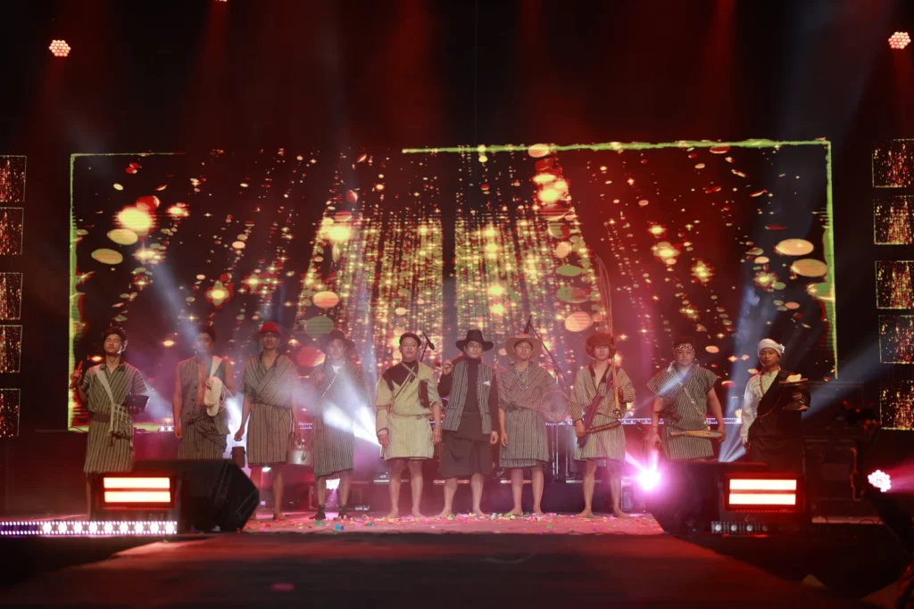
The Sun Rise Festival
The inaugural Sun Rise Festival ran from 29 December 2025 to 2 January 2026, timed around New Year. Expect cultural performances by Meyor and Mishmi troupes, local food — thukpa, lukter (dried meat with chilli), apong (fermented rice beer) — craft stalls, and guided nature walks. Check the official Arunachal Pradesh Tourism site for current dates before you plan around it.
Permits for Dong Valley
Indian nationals need both an ILP and a PAP. Apply for the ILP online — ₹300 for up to 3 days, ₹500 for up to 14, processed in 24–48 hours. The PAP for Anjaw’s border zone is best arranged through a registered tour operator well ahead of travel. See our Northeast India travel permits guide for the fuller regional picture. Foreign nationals are barred entirely from the Kibithu-Kaho border zone, even with a PAP.
Also, check out: NorthEast India Permit Assistant
Travel Checklist
- Carry 6+ printed copies each of your ILP and PAP.
- Fuel up fully in Tezu, then again at Khupa — the last pump before Walong.
- Withdraw cash in Hayuliang, the last ATM on the route.
- Pack serious warm layers for the 2 am ridgeline climb.
- Bring a headlamp with spare batteries.
- Leave your drone at home — the area sits inside India’s 25 km border no-fly zone.
- Share your route with someone before you lose network at Hayuliang.
Final Thoughts
Dong Valley is not a comfortable trip, and that’s precisely the point. A village of nine families, a two-hour night hike, a ridgeline in the Eastern Himalayas, and the first light in India hitting the mountains above you at 4.30 in the morning — there’s nowhere else in the country you can do all of that in one morning. Go before the Sun Rise Festival grows into something too crowded to feel like a frontier experience.
For more from this part of Northeast India, read our Northeast India tourism guide or plan your permits early with our Arunachal Pradesh travel permits guide.
